Pirineos. (1813).) . Mapas militares. ( 1848
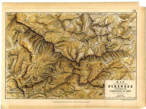
Map of part of the Pyrenees to illustrate the campaign of 1813 [Material cartográfico] / A.K. Johnston.
Edinburgh ; London : William Blackwood & Sons, [s.a.]
1 mapa : grabado al acero ; ; 147 mm. x 204 mm. en hoja de 180 mm. x 225 mm.
Imagen (cartográfica ; fija ; bidimensional ; visual)
sin mediación
En la parte inferior derecha: cartela con título y escala.
En la parte superior derecha fuera del marco consta el número "72"
En la parte superior derecha fuera del marco consta el número "72"
Procede de la obra: "Atlas to Alison`s History of Europe constructed and arranged, under the direction of Mr. Alison by Alex Keith Johnston, F.R." (Edinburgh and London: William Blackwood and Sons, 1848)
https://binadi.navarra.es/registro/00025497
OAI